In this study, a simulation was developed for the downtown area of Toronto, focusing on one of the city’s busiest and most dynamic regions. The model represents transportation activity during the morning peak hour, between 7:00 AM and 8:00 AM.
Toronto’s public transportation network is large and diverse, consisting of 4 subway lines, 11 streetcar routes, and approximately 160 bus lines. This level of complexity makes both the creation and analysis of the simulation more challenging, as it requires accurately modeling the interactions between different transportation modes.
Simulation Overview:
Transit System: Bus, subway, and streetcar stops, routes, and schedules were modeled using current and real-world data.
Infrastructure: The simulation map and infrastructure components were created using OpenStreetMap (OSM) data. Roads, rail lines, bike lanes, pedestrian crossings, and traffic signals were all simulated to match their real-life counterparts in terms of location, length, width, and speed limits.
Simulation Results: Although the full analysis is still ongoing, the results obtained so far indicate that the model performs accurately and reliably. As with all simulations, it is important to note that there is no such thing as a “perfectly accurate” model—only simulations that closely approximate reality.
Additional Information: The simulation was developed using only SUMO and OSM software, along with their respective open-source tools and data. The downtown map and the subway and streetcar network maps used in the presentation were sourced from the official Toronto Transit Commission (TTC) website.
Note: While this simulation was developed using scientific methods, it is not part of a formal academic or peer-reviewed research project. Additionally, no commercial revenue has been generated from this work.
Yours sincerely,
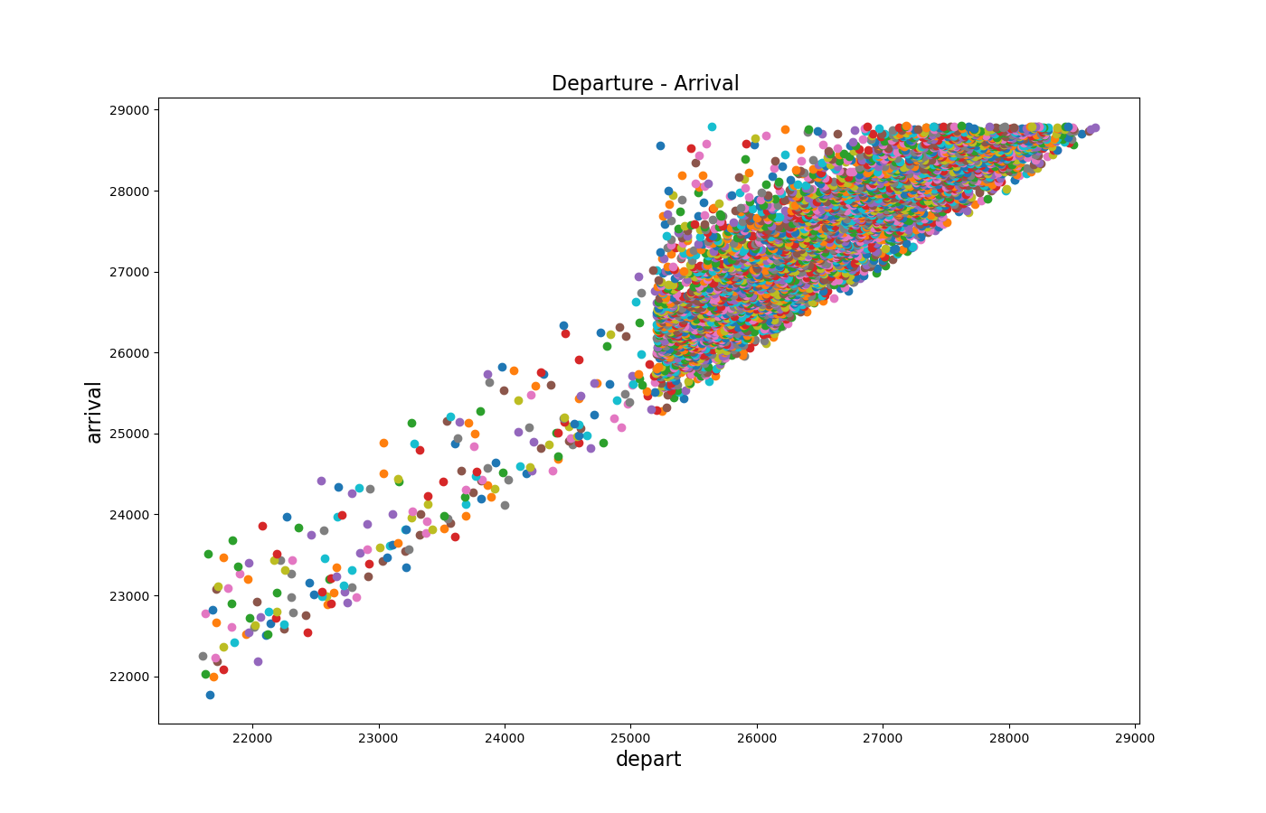
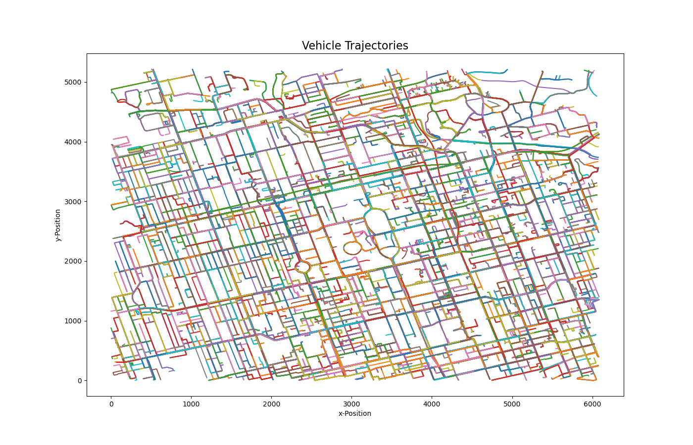
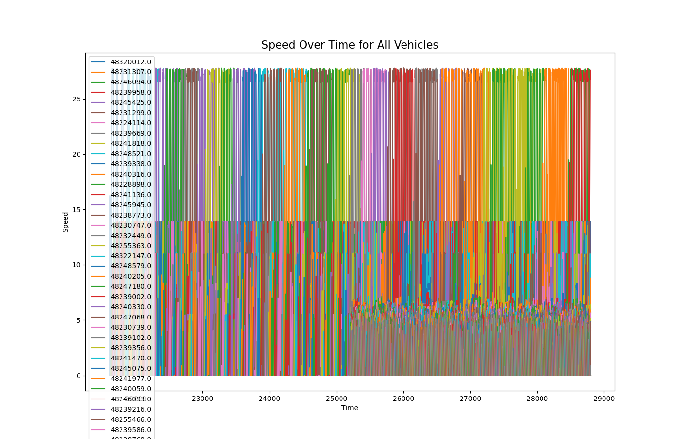
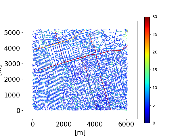
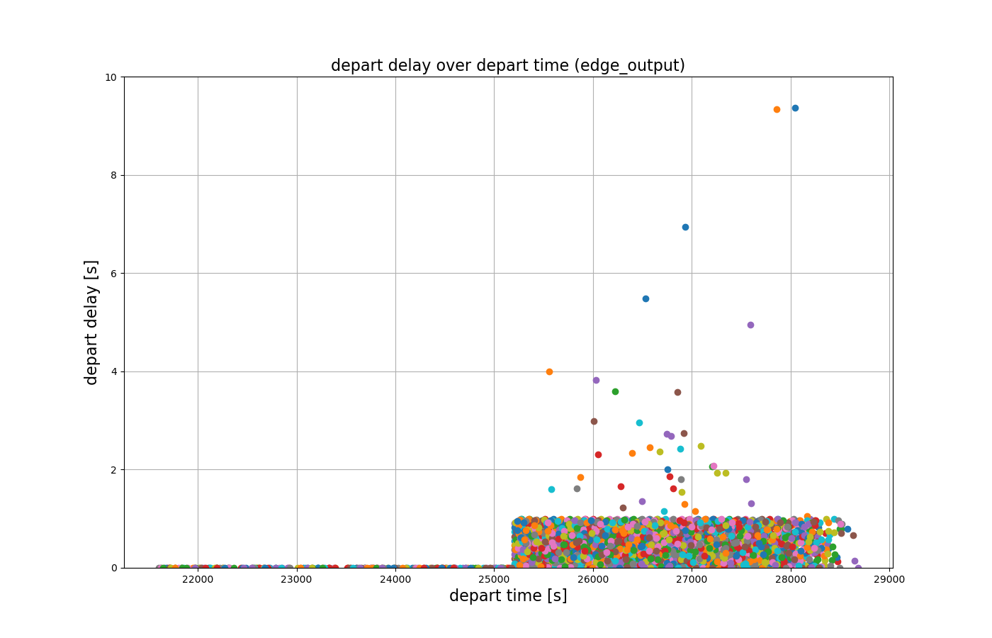
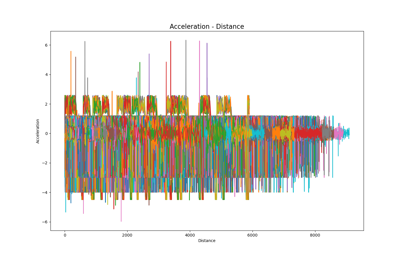
The data analyses will be added soon.
The data analyses will be added soon.
The data analyses will be added soon.
The data analyses will be added soon.
The data analyses will be added soon.
The data analyses will be added soon.
The data analyses will be added soon.
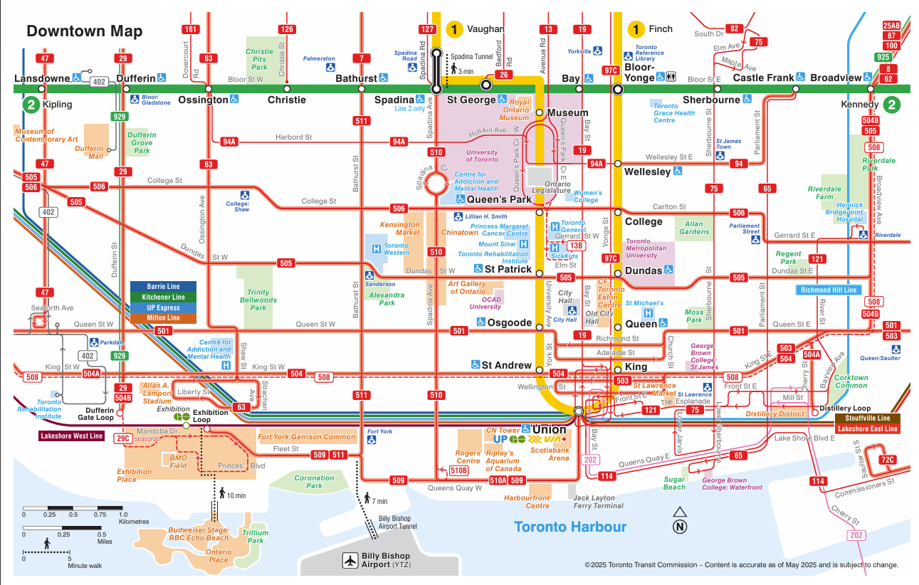
Toronto Downtown Map – sourced from the Toronto Transit Commission website.
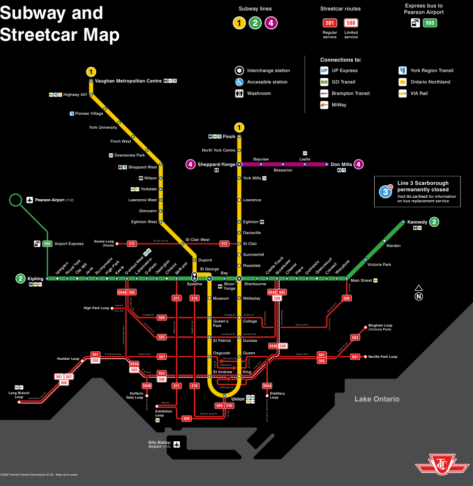
Toronto Subway and Streetcar Map – sourced from the Toronto Transit Commission website.